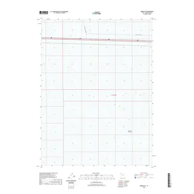
2020 Map of Arinosa NE
USGS Topo · Published 2020About this map
The Great Salt Lake Desert dominates this section of Tooele County, presenting a stark expanse defined by its extreme flatness and minimalist human presence. The landscape is primarily shaped by the vast salt crusts and seasonal variations of this unique environment. Crossing the northern portion of the quadrangle, the 80 provides the primary corridor for transcontinental travel, flanked by the industrial and functional Floating Island Dike Rd. This survey reflects the modern infrastructure required to traverse one of the most inhospitable yet geographically significant regions in the American West. The grid-like division of township t1.5s r15w underscores the systematic mapping of this arid basin where few natural landmarks exist outside the occasional topographic variation.
Find a feature on this map
4 named features on this map. Tap any name to fly to it.
Don’t see what you’re looking for? This feature index may not catch every label — zoom into the map to look around manually.
Map Details
Editions of this 2020 Arinosa NE Map
This is the sole edition of this map. No revisions or reprints were ever made.
Other maps of this area

1953 · Tooele
USGS Topo · 1:250,000

1955 · Tooele
USGS Topo · 1:250,000

1973 · Knolls SW
USGS Topo · 1:24,000

1973 · Arinosa
USGS Topo · 1:24,000

1973 · Arinosa SE
USGS Topo · 1:24,000

1973 · Floating Island SW
USGS Topo · 1:24,000

1973 · Arinosa SW
USGS Topo · 1:24,000

1973 · Arinosa NE
USGS Topo · 1:24,000

1973 · Floating Island SE
USGS Topo · 1:24,000

1973 · Barro
USGS Topo · 1:24,000