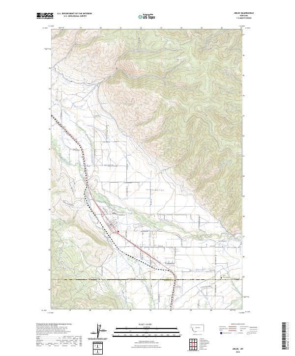
2024 Map of Arlee
USGS Topo · Published 2024About this map
Arlee serves as the central hub for this portion of the Jocko Valley, situated where the Jocko River meets a network of vital irrigation systems including the K Canal and E Canal. The landscape is defined by the sharp transition from the valley floor to the high elevations of Picture Mountain, with numerous drainages like North Lamoose Creek and Pistol Creek carving through the northern heights. This 2024 survey captures the intricate local road network that branches out from the town center, naming routes such as Pow Wow Rd and Blackhawk Loop. For those researching local heritage, the Jocko Church Cem is noted near Agency Creek, marking a site of community and genealogical significance within the valley's established settlement pattern.
Find a feature on this map
63 named features on this map. Tap any name to fly to it.
Don’t see what you’re looking for? This feature index may not catch every label — zoom into the map to look around manually.
Map Details
Editions of this 2024 Arlee Map
This is the sole edition of this map. No revisions or reprints were ever made.
Other maps of this area

1921 · Elbow Lake
USGS Topo · 1:125,000

1955 · Choteau
USGS Topo · 1:250,000

1956 · Wallace
USGS Topo · 1:250,000

1957 · Choteau
USGS Topo · 1:250,000

1958 · Choteau
USGS Topo · 1:250,000

1959 · Arlee
USGS Topo · 1:62,500

1960 · Wallace
USGS Topo · 1:250,000

1962 · Choteau
USGS Topo · 1:250,000

1964 · Saint Ignatius
USGS Topo · 1:24,000

1964 · Ravalli
USGS Topo · 1:24,000