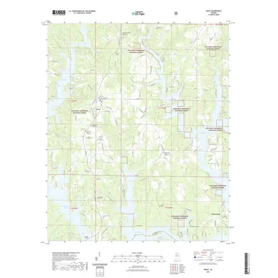
2021 Map of Arley
USGS Topo · Published 2021About this map
The settlement of Arley serves as the focal point for this survey of eastern Winston County, where the dendritic fingers of Lewis Smith Lake reach deep into the surrounding terrain. Much of the landscape is defined by the William B. Bankhead National Forest, creating a mosaic of public and private land. For genealogists, the map is remarkably dense with family-named landmarks and historical burial sites, including the Trussell Cemetery, Kennedy Cemetery, and Taylor Hill Cemetery.
Find a feature on this map
134 named features on this map. Tap any name to fly to it.
Don’t see what you’re looking for? This feature index may not catch every label — zoom into the map to look around manually.
Map Details
Editions of this 2021 Arley Map
This is the sole edition of this map. No revisions or reprints were ever made.
Other maps of this area

1893 · Jasper
USGS Topo · 1:125,000

1949 · Cold Springs
USGS Topo · 1:24,000

1949 · Manchester
USGS Topo · 1:24,000

1949 · Sunlight
USGS Topo · 1:24,000

1950 · Manchester
USGS Topo · 1:24,000

1951 · Cold Springs
USGS Topo · 1:24,000
1951 · Sunlight
USGS Topo · 1:24,000

1953 · Birmingham
USGS Topo · 1:250,000

1956 · Birmingham
USGS Topo · 1:250,000

1956 · Gadsden
USGS Topo · 1:250,000