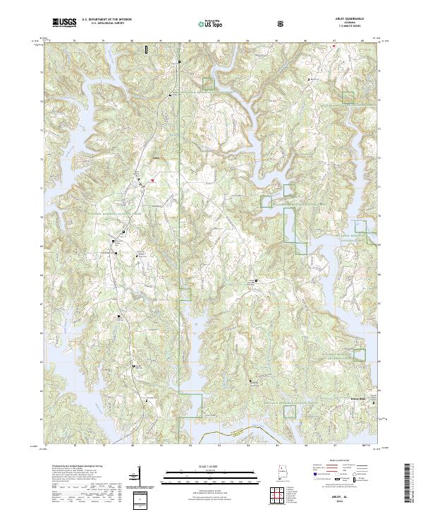
2024 Map of Arley
USGS Topo · Published 2024About this map
Arley and Wilson Bend serve as the primary human settlements in this portion of Winston County, where the landscape is defined by the extensive reaches of Lewis Smith Lake. Much of the territory is protected within the William B. Bankhead National Forest, preserving the wooded drainages of the Sipsey Fork and Brushy Creek. The area maintains a high density of small burial grounds, offering significant value for genealogical research. Notable sites include the Trussell Family Cem, Meek Baptist Cem, and the Arley First Baptist Cem. The network of backroads like Old Houston Rd and Old Arley Rd reflects the long-standing agricultural and timber-based economy of the region, where numerous creeks such as Dismal Creek and Cutoff Branch carve through the terrain toward the reservoir's fingers.
Find a feature on this map
145 named features on this map. Tap any name to fly to it.
Don’t see what you’re looking for? This feature index may not catch every label — zoom into the map to look around manually.
Map Details
Editions of this 2024 Arley Map
This is the sole edition of this map. No revisions or reprints were ever made.
Other maps of this area

1893 · Jasper
USGS Topo · 1:125,000

1949 · Cold Springs
USGS Topo · 1:24,000

1949 · Manchester
USGS Topo · 1:24,000

1949 · Sunlight
USGS Topo · 1:24,000

1950 · Manchester
USGS Topo · 1:24,000

1951 · Cold Springs
USGS Topo · 1:24,000
1951 · Sunlight
USGS Topo · 1:24,000

1953 · Birmingham
USGS Topo · 1:250,000

1956 · Birmingham
USGS Topo · 1:250,000

1956 · Gadsden
USGS Topo · 1:250,000