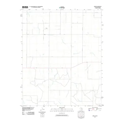
2010 Map of Arlie
USGS Topo · Published 2010About this map
Arlie sits in the northwest portion of this 2010 topographic survey, a small settlement located at the junction of Fm 1034 and several county roads. The landscape is defined by the dendritic drainage of the West Fork Sandy Creek, which winds generally southeast through the center of the sheet. For genealogists and local historians, the Arlie Cemetery is a prominent landmark north of the main settlement area, providing a specific geographic point of interest for family research.
Find a feature on this map
15 named features on this map. Tap any name to fly to it.
Don’t see what you’re looking for? This feature index may not catch every label — zoom into the map to look around manually.
Map Details
Editions of this 2010 Arlie Map
This is the sole edition of this map. No revisions or reprints were ever made.
Other maps of this area

1954 · Plainview
USGS Topo · 1:250,000

1955 · Lawton
USGS Topo · 1:250,000

1958 · Plainview
USGS Topo · 1:250,000

1960 · Loco
USGS Topo · 1:62,500

1961 · Hollis
USGS Topo · 1:62,500

1964 · Wellington
USGS Topo · 1:24,000

1964 · Dodson
USGS Topo · 1:24,000
1971 · Mc Knight
USGS Topo · 1:24,000
1975 · Hollis NW
USGS Topo · 1:24,000
1984 · Arlie
USGS Topo · 1:24,000