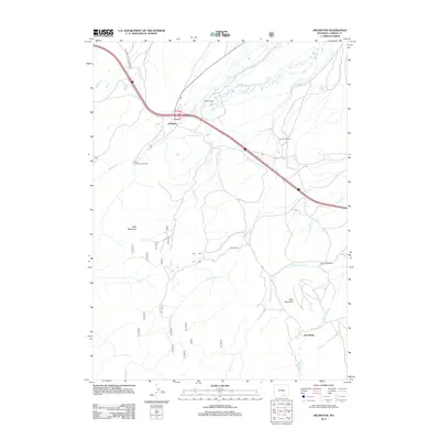
2012 Map of Arlington
USGS Topo · Published 2012About this map
Arlington and several surrounding ranching properties sit at the base of the Laramie Mountains in this 2012 survey of Carbon County. The landscape is defined by a dense network of watercourses flowing toward the Laramie River basin, including Onemile Cr, Threemile Cr, and Elk Cr. Established ranching operations such as Brokaw Ranch, Old Fisher Ranch, and the White Ranch are scattered across the high plains, illustrating the continued agricultural character of this Wyoming high-country corridor.
Find a feature on this map
20 named features on this map. Tap any name to fly to it.
Don’t see what you’re looking for? This feature index may not catch every label — zoom into the map to look around manually.
Map Details
Editions of this 2012 Arlington Map
This is the sole edition of this map. No revisions or reprints were ever made.
Other maps of this area

1906 · Medicine Bow
USGS Topo · 1:125,000

1908 · Medicine Bow
USGS Topo · 1:125,000

1954 · Rawlins
USGS Topo · 1:250,000

1958 · Rawlins
USGS Topo · 1:250,000

1958 · White Rock Canyon
USGS Topo · 1:24,000

1958 · Bengough Hill
USGS Topo · 1:24,000

1958 · Arlington
USGS Topo · 1:24,000

1958 · Mc Fadden
USGS Topo · 1:24,000
1958 · Pierce Reservoir
USGS Topo · 1:24,000

1958 · T L Ranch
USGS Topo · 1:24,000