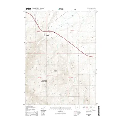
2015 Map of Arlington
USGS Topo · Published 2015About this map
Arlington sits as a central point of navigation in this high-altitude landscape where the plains of Wyoming meet the rising northern slopes of the Medicine Bow Mountains. The settlement pattern follows the established corridors of the Rock Creek Trl and Wagonhound Rd, reflecting historical transit routes that predated the modern interstate. To the south, the topography shifts dramatically as the land enters the Medicine Bow National Forest, defined by significant peaks such as Rock Mtn and Deer Mtn. This area is characterized by a complex drainage network, including W Fork Dutton Cr and E Fork Dutton Cr, which carve through the foothills near Woodedge. The presence of Cooper Hill further south marks the transition into the higher timbered reaches of the national forest, illustrating the historical importance of these mountain gateways for both early travel and water resource management.
Find a feature on this map
23 named features on this map. Tap any name to fly to it.
Don’t see what you’re looking for? This feature index may not catch every label — zoom into the map to look around manually.
Map Details
Editions of this 2015 Arlington Map
This is the sole edition of this map. No revisions or reprints were ever made.
Other maps of this area

1906 · Medicine Bow
USGS Topo · 1:125,000

1908 · Medicine Bow
USGS Topo · 1:125,000

1954 · Rawlins
USGS Topo · 1:250,000

1958 · Rawlins
USGS Topo · 1:250,000

1958 · White Rock Canyon
USGS Topo · 1:24,000

1958 · Bengough Hill
USGS Topo · 1:24,000

1958 · Arlington
USGS Topo · 1:24,000

1958 · Mc Fadden
USGS Topo · 1:24,000
1958 · Pierce Reservoir
USGS Topo · 1:24,000

1958 · T L Ranch
USGS Topo · 1:24,000