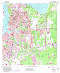
1963 Map of Arlington
USGS Topo · Published 1982About this map
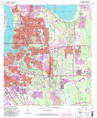
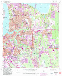
St Johns River and its eastern banks define this landscape during a period of rapid suburban expansion in Jacksonville. The urban core gives way to established riverside communities like Floral Bluff and Arlington, while newer residential developments such as Sandalwood and Southside Estates push eastward into the Big Island Swamp. This 1981 revision highlights the growth of major institutional footprints, including the Jacksonville University campus on the river and the burgeoning University of North Florida to the southeast.
Find a feature on this map
126 named features on this map. Tap any name to fly to it.
Don’t see what you’re looking for? This feature index may not catch every label — zoom into the map to look around manually.
Map Details
Editions of this 1963 Arlington Map
6 editions found
Other maps of this area

1917 · Orange Park
USGS Topo · 1:62,500

1918 · Jacksonville
USGS Topo · 1:62,500

1918 · Orange Park
USGS Topo · 1:62,500

1918 · Palm Valley
USGS Topo · 1:62,500

1918 · Mayport
USGS Topo · 1:62,500

1948 · Jacksonville
USGS Topo · 1:250,000

1948 · Jacksonville Beach
USGS Topo · 1:24,000

1948 · Eastport
USGS Topo · 1:24,000

1949 · Jacksonville Beach
USGS Topo · 1:24,000

1950 · Arlington
USGS Topo · 1:24,000
Featured Places
- Jacksonville, FL
- Holiday Hill, Jacksonville
- Newcastle, Jacksonville
- Hogan, Jacksonville
- Bridgewater, Jacksonville