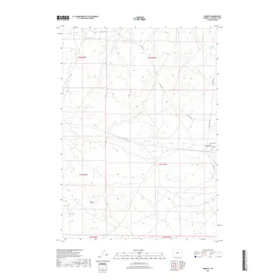
2017 Map of Arminto
USGS Topo · Published 2017About this map
The high plains of Natrona County center on the small settlement of Arminto, a remote outpost where the sagebrush landscape is punctuated by vital water catchments and historic ranching routes. Water management defines the terrain, visible through features like the Jackpot Reservoir in the northeast and Garrison Reservoir along Garrison Draw to the southwest. These scattered reservoirs, including the Bad Water Cr Reservoir, serve as critical infrastructure in a dry environment etched by seasonal drainages such as Red Cr and Alkali Cr.
Find a feature on this map
19 named features on this map. Tap any name to fly to it.
Don’t see what you’re looking for? This feature index may not catch every label — zoom into the map to look around manually.
Map Details
Editions of this 2017 Arminto Map
This is the sole edition of this map. No revisions or reprints were ever made.
Other maps of this area

1952 · Deadman Butte
USGS Topo · 1:24,000

1952 · Badwater
USGS Topo · 1:24,000

1952 · Arminto
USGS Topo · 1:24,000

1952 · Arminto SW
USGS Topo · 1:24,000

1952 · Arminto NW
USGS Topo · 1:24,000

1952 · Waltman NW
USGS Topo · 1:24,000

1952 · Waltman
USGS Topo · 1:24,000

1952 · Hiland
USGS Topo · 1:24,000

1952 · Badwater SE
USGS Topo · 1:24,000

1955 · Arminto
USGS Topo · 1:250,000