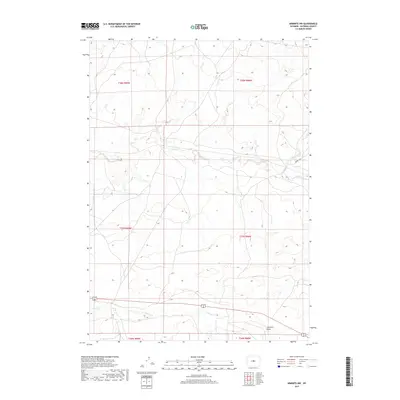
2017 Map of Arminto NW
USGS Topo · Published 2017About this map
Alkali Creek and its many seasonal tributaries dominate this high-desert landscape in Natrona County. The drainage network follows a deeply etched pattern through the northern half of the survey, where Alkali Creek and Red Creek cut across the arid terrain. The central and southern reaches are defined by wide, dry depressions such as Garrison Draw, typical of the central Wyoming basin. The limited human imprint is focused primarily on the east-west corridor of Arminto Rd, which provides one of the few managed routes through these open range lands. In the southern portion of the map, the terrain shifts toward the Poison Creek drainage, illustrating the complex hydrology of a region where water is a scarce but landscape-defining force.
Find a feature on this map
13 named features on this map. Tap any name to fly to it.
Don’t see what you’re looking for? This feature index may not catch every label — zoom into the map to look around manually.
Map Details
Editions of this 2017 Arminto NW Map
This is the sole edition of this map. No revisions or reprints were ever made.
Other maps of this area

1952 · Badwater
USGS Topo · 1:24,000

1952 · Arminto
USGS Topo · 1:24,000

1952 · Arminto SW
USGS Topo · 1:24,000

1952 · Madden
USGS Topo · 1:24,000

1952 · Arminto NW
USGS Topo · 1:24,000

1952 · Lysite SE
USGS Topo · 1:24,000

1952 · Moneta SE
USGS Topo · 1:24,000

1952 · Hiland
USGS Topo · 1:24,000

1952 · Badwater SE
USGS Topo · 1:24,000

1955 · Arminto
USGS Topo · 1:250,000