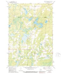
1972 Map of Armstrong Creek
USGS Topo · Published 1989About this map
The boundary between Forest, Florence, and Marinette Counties meets in this remote northern woodland, where the settlement of Armstrong Creek serves as a central point of reference. The landscape is defined by the extensive Nicolet National Forest and a complex network of glacial water bodies, including Oneonta Lake, Hilbert Lake, and the winding Armstrong Creek. Small-scale community life is evident in the presence of Hillside Cem and Pine Hill Cem, providing important markers for local genealogists studying the families of Fence.
Find a feature on this map
38 named features on this map. Tap any name to fly to it.
Don’t see what you’re looking for? This feature index may not catch every label — zoom into the map to look around manually.
Map Details
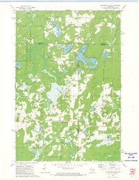
Editions of this 1972 Armstrong Creek Map
2 editions found
Other maps of this area

1939 · Goodman
USGS Topo · 1:48,000

1939 · Laona
USGS Topo · 1:48,000

1939 · Long Lake
USGS Topo · 1:48,000

1941 · Florence
USGS Topo · 1:48,000

1946 · Laona
USGS Topo · 1:48,000

1946 · Goodman
USGS Topo · 1:48,000

1948 · Long Lake
USGS Topo · 1:48,000

1954 · Iron Mountain
USGS Topo · 1:250,000

1959 · Iron Mountain
USGS Topo · 1:250,000
1962 · Florence SW
USGS Topo · 1:24,000