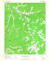
1964 Map of Arnett
USGS Topo · Published 1966About this map
Marsh Fork flows through the heart of this Appalachian landscape, where narrow valley settlements like Arnett and Masseyville follow the winding river corridor. In the mid-1960s, the region was defined by a complex network of resource extraction and community infrastructure, evidenced by numerous Gas Wells and Strip Mines dotted across Guyandotte Mountain and Peachtree Ridge. The map reveals a dense social fabric of rural life, with family-named burial grounds such as Richmond Cem and Sarrett-Lemon Cem located near local landmarks like the Mt View Sch and Flat Branch Ch. The topography is particularly detailed between the Raleigh Co and Wyoming Co border, showing the steep elevation changes near Ivy Knob and its Lookout Tower, illustrating the isolation and specialized development of these coal-country hollows.
Find a feature on this map
92 named features on this map. Tap any name to fly to it.
Don’t see what you’re looking for? This feature index may not catch every label — zoom into the map to look around manually.
Map Details
Editions of this 1964 Arnett Map
4 editions found
Other maps of this area

1891 · Oceana
USGS Topo · 1:125,000

1891 · Raleigh
USGS Topo · 1:125,000

1893 · Oceana
USGS Topo · 1:125,000

1897 · Raleigh
USGS Topo · 1:125,000

1898 · Oceana
USGS Topo · 1:125,000

1902 · Raleigh
USGS Topo · 1:125,000

1910 · Pineville
USGS Topo · 1:48,000

1910 · Bald Knob
USGS Topo · 1:48,000

1911 · Marshes
USGS Topo · 1:48,000

1912 · Mullens
USGS Topo · 1:62,500