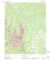
1964 Map of Arnett
USGS Topo · Published 1989About this map
The rugged coal and gas territory along the Raleigh Co and Wyoming Co border is defined by a dense network of family cemeteries and small rural settlements. Following the winding course of the Marsh Fork, communities like Naoma, Arnett, and Masseyville are hemmed in by steep ridges including Peachtree Ridge and Spring Mountain. The landscape is a mix of traditional Appalachian hill life and industrial extraction, evidenced by numerous Gas Wells and a Strip Mine on the eastern edge near Clear Fork.
Find a feature on this map
74 named features on this map. Tap any name to fly to it.
Don’t see what you’re looking for? This feature index may not catch every label — zoom into the map to look around manually.
Map Details
Editions of this 1964 Arnett Map
4 editions found
Other maps of this area

1891 · Oceana
USGS Topo · 1:125,000

1891 · Raleigh
USGS Topo · 1:125,000

1893 · Oceana
USGS Topo · 1:125,000

1897 · Raleigh
USGS Topo · 1:125,000

1898 · Oceana
USGS Topo · 1:125,000

1902 · Raleigh
USGS Topo · 1:125,000

1910 · Pineville
USGS Topo · 1:48,000

1910 · Bald Knob
USGS Topo · 1:48,000

1911 · Marshes
USGS Topo · 1:48,000

1912 · Mullens
USGS Topo · 1:62,500