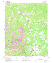
1964 Map of Arnett
USGS Topo · Published 1977About this map
Marsh Fork winds through the heart of this Appalachian landscape, serving as a primary corridor for small settlements like Rock Creek, Masseyville, and Arnett. The 1964 survey captures a moment when the coal and gas economy shaped the terrain, with numerous Gas Wells and Strip Mines appearing alongside established family landmarks. The cultural geography is defined by an exceptional density of family cemeteries, including the Scarborough Cem, McGinnis Cem, and Massey Cem, reflecting deep-rooted genealogical ties across Peachtree Ridge and Spring Mountain.
Find a feature on this map
94 named features on this map. Tap any name to fly to it.
Don’t see what you’re looking for? This feature index may not catch every label — zoom into the map to look around manually.
Map Details
Editions of this 1964 Arnett Map
4 editions found
Other maps of this area

1891 · Oceana
USGS Topo · 1:125,000

1891 · Raleigh
USGS Topo · 1:125,000

1893 · Oceana
USGS Topo · 1:125,000

1897 · Raleigh
USGS Topo · 1:125,000

1898 · Oceana
USGS Topo · 1:125,000

1902 · Raleigh
USGS Topo · 1:125,000

1910 · Pineville
USGS Topo · 1:48,000

1910 · Bald Knob
USGS Topo · 1:48,000

1911 · Marshes
USGS Topo · 1:48,000

1912 · Mullens
USGS Topo · 1:62,500