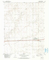
1979 Map of Arriba
USGS Topo · Published 1979About this map
Arriba sits at the heart of this high-plains landscape, defined by its role as a rail town along the Chicago Rock Island and Pacific railroad. The town's grid is concentrated near a central Park, with the railroad running parallel to the highway. This late-1970s survey captures a transition between traditional agriculture and modern infrastructure, evidenced by the presence of a Landing Strip to the west and a prominent Pipeline cutting across the northern sections.
Find a feature on this map
11 named features on this map. Tap any name to fly to it.
Don’t see what you’re looking for? This feature index may not catch every label — zoom into the map to look around manually.
Map Details
Editions of this 1979 Arriba Map
2 editions found
Other maps of this area

1954 · Limon
USGS Topo · 1:250,000

1957 · Limon
USGS Topo · 1:250,000

1958 · Limon
USGS Topo · 1:250,000

1978 · Hugo 4 NW
USGS Topo · 1:24,000

1979 · Arriba NW
USGS Topo · 1:24,000

1979 · Sevenmile Ranch
USGS Topo · 1:24,000

1979 · Arriba
USGS Topo · 1:24,000

1979 · Flagler SW
USGS Topo · 1:24,000

1979 · Genoa East
USGS Topo · 1:24,000

1979 · Flagler NW
USGS Topo · 1:24,000