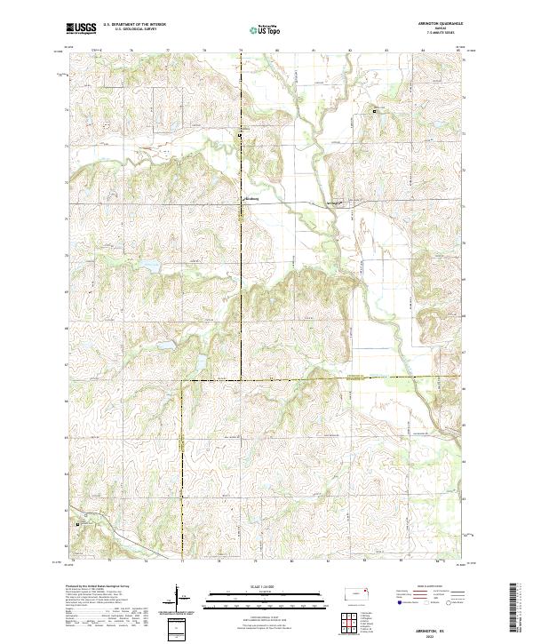
2022 Map of Arrington
USGS Topo · Published 2022About this map
The Delaware River winds through the rural landscape of this northeastern Kansas region, defining a topography of gentle valleys and upland plateaus. The small settlement of Arrington is positioned near the river banks, while to the west, Larkinburg sits along the county line. This survey captures a quiet, agricultural pocket of the state where Jackson, Atchison, and Jefferson counties meet, a nexus marked by a network of sectional roads and family-named routes like Barton Rd and Sherman Rd.
Find a feature on this map
45 named features on this map. Tap any name to fly to it.
Don’t see what you’re looking for? This feature index may not catch every label — zoom into the map to look around manually.
Map Details
Editions of this 2022 Arrington Map
This is the sole edition of this map. No revisions or reprints were ever made.
Other maps of this area

1885 · Atchison
USGS Topo · 1:125,000

1886 · Oskaloosa
USGS Topo · 1:125,000

1888 · Oskaloosa
USGS Topo · 1:125,000

1888 · Atchison
USGS Topo · 1:125,000

1888 · Hiawatha
USGS Topo · 1:125,000

1889 · Topeka
USGS Topo · 1:125,000

1893 · Atchison
USGS Topo · 1:125,000

1894 · Oskaloosa
USGS Topo · 1:125,000

1894 · Topeka
USGS Topo · 1:125,000

1894 · Hiawatha
USGS Topo · 1:125,000