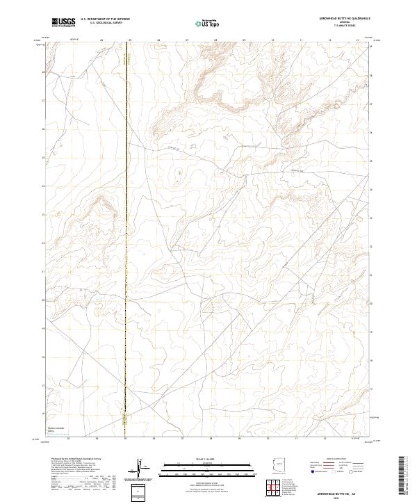
2021 Map of Arrowhead Butte NE
USGS Topo · Published 2021About this map
Pueblo Colorado Valley anchors this high-desert landscape, where the wide floor of the Pueblo Colorado Wash cuts through the northeast corner of the Arizona territory. This 2021 update reveals a complex network of regional transit lines crossing the open terrain, including Indian Rte 9606 and several smaller routes like N-9608 and N-9003. The map documents the precise intersection of the Navajo and Apache county lines, providing a clear view of the modern administrative boundaries and township grids, including sections of t24n r23e and t23n r24e. The topography is characterized by subtle elevation changes and the dry wash drainage patterns common to this part of the Southwest.
Find a feature on this map
12 named features on this map. Tap any name to fly to it.
Don’t see what you’re looking for? This feature index may not catch every label — zoom into the map to look around manually.
Map Details
Editions of this 2021 Arrowhead Butte NE Map
This is the sole edition of this map. No revisions or reprints were ever made.
Other maps of this area

1886 · Fort Defiance
USGS Topo · 1:250,000

1892 · Fort Defiance
USGS Topo · 1:250,000

1954 · Gallup
USGS Topo · 1:250,000

1958 · Gallup
USGS Topo · 1:250,000

1959 · Gallup
USGS Topo · 1:250,000

1962 · Gallup
USGS Topo · 1:250,000

1967 · Gallup
USGS Topo · 1:250,000
1972 · Tanner Springs
USGS Topo · 1:24,000
1972 · Greasewood
USGS Topo · 1:24,000
1972 · Arrowhead Butte
USGS Topo · 1:24,000