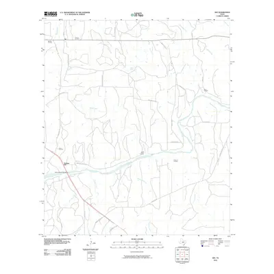
2010 Map of Art
USGS Topo · Published 2010About this map
Hedwigs Hill and the community of Art anchor this landscape along the Llano River in Mason County. The map reveals a high concentration of family-named burial grounds, including the West Art Cemetery, East Art Cemetery, Kothmann Cemetery, and Bauer Cemetery, which speak to the deep-rooted German-Texan genealogy of the region. Local water sources like Mulberry Spring and a dense network of drainages such as Twelvemile Creek and Pluenneke Creek define the ranching terrain. The road network connects these historic nodes via routes like Art-Hedwigs Hill Rd and Maso-Llan Rd, while the State Highway 9 Bridge provides a primary crossing over the river. This modern survey effectively documents the intersection of legacy family lands and the enduring geography of the Texas Hill Country.
Find a feature on this map
39 named features on this map. Tap any name to fly to it.
Don’t see what you’re looking for? This feature index may not catch every label — zoom into the map to look around manually.
Map Details
Editions of this 2010 Art Map
This is the sole edition of this map. No revisions or reprints were ever made.
Other maps of this area

1887 · Llano
USGS Topo · 1:125,000

1887 · Mason
USGS Topo · 1:125,000

1894 · Mason
USGS Topo · 1:125,000

1894 · Llano
USGS Topo · 1:125,000

1904 · Llano
USGS Topo · 1:125,000

1909 · Llano
USGS Topo · 1:125,000

1918 · Llano
USGS Topo · 1:125,000

1954 · Llano
USGS Topo · 1:250,000

1955 · Llano
USGS Topo · 1:250,000
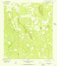
1955 · Smoothingiron Mountain
USGS Topo · 1:24,000