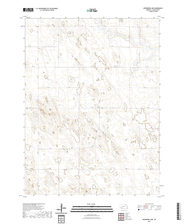
2021 Map of Arterburn Lake
USGS Topo · Published 2021About this map
Mcguires Slough defines the northeastern drainage of this high plains landscape in Chase, Nebraska. The terrain is characterized by a high-altitude plateau incised by subtle draws and seasonal drainages, navigated by a rigid grid of section-line roads. These routes, including 314 Ave and 316 Ave, trace the boundaries of the Public Land Survey System divisions such as t6n r41w and t5n r40w. The mapping of these section lines reveals the persistent agricultural organization of the Great Plains, where long-established range and township lines continue to dictate the placement of transportation corridors like 732 Rd and 730 Rd.
Find a feature on this map
22 named features on this map. Tap any name to fly to it.
Don’t see what you’re looking for? This feature index may not catch every label — zoom into the map to look around manually.
Map Details
Editions of this 2021 Arterburn Lake Map
This is the sole edition of this map. No revisions or reprints were ever made.
Other maps of this area

1954 · Sterling
USGS Topo · 1:250,000

1954 · McCook
USGS Topo · 1:250,000

1957 · McCook
USGS Topo · 1:250,000

1958 · McCook
USGS Topo · 1:250,000

1958 · Sterling
USGS Topo · 1:250,000

1961 · Lamar
USGS Topo · 1:24,000

1971 · Amherst SE
USGS Topo · 1:24,000

1971 · Alvin
USGS Topo · 1:24,000

1971 · Alvin NE
USGS Topo · 1:24,000
1973 · Lamar
USGS Topo · 1:24,000