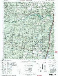
2001 Map of Artesia
USGS Topo · Published 2001About this map
Artesia Wells sits along the eastern edge of this landscape, positioned where the Union Pacific railroad corridor cuts through South Texas brush country. This era of the South Texas rangeland is defined by large-scale cattle operations and land stewardship, evidenced by the vast Chaparral Wildlife Management Area and numerous family-named properties such as Cochina Ranch, Richey Ranch, and Flying W Ranch. The hydrology of the region is centered on the Nueces River, which meanders across the northern section of the sheet, supported by drainage from Sage Creek and Mocho Creek. Local infrastructure is adapted to this ranching environment, with specialized landmarks like the Rancho Encantada Hard surface 174 and multiple remote landing strips including Airfield Soft surface 190. Numerous windmills and earthen dams across the quadrangle illustrate the critical importance of water management in this arid environment.
Find a feature on this map
15 named features on this map. Tap any name to fly to it.
Don’t see what you’re looking for? This feature index may not catch every label — zoom into the map to look around manually.
Map Details
Editions of this 2001 Artesia Map
This is the sole edition of this map. No revisions or reprints were ever made.
Other maps of this area

1925 · San Roque Lake 1-a
USGS Topo · 1:48,000

1927 · Bart
USGS Topo · 1:62,500

1929 · Cotulla
USGS Topo · 1:125,000

1932 · Valley Wells
USGS Topo · 1:62,500

1939 · Big Wells
USGS Topo · 1:62,500

1940 · Cotulla
USGS Topo · 1:62,500

1940 · Velenzuela Creek
USGS Topo · 1:62,500

1940 · Catarina
USGS Topo · 1:62,500

1940 · Artesia Wells
USGS Topo · 1:62,500

1942 · Dilley
USGS Topo · 1:62,500