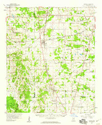
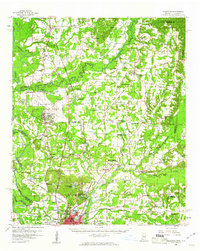
1959 Map of Artesia
USGS Topo · Published 1960About this map
The Gulf Mobile And Ohio railroad acts as the central artery through this prairie landscape, connecting the primary settlements of Artesia, Crawford, and Mayhew. This network supported a dense distribution of rural institutions during the late 1950s, evidenced by the numerous country churches and schools like Prairie Grove Ch and Truevine Sch scattered across the Oktibbeha and Lowndes county lines. The map reveals a transition from the structured airfield at Oktibbeha Airport to the undeveloped wetlands of the Noxubee River bottomlands. In the southwest corner, the establishment of the National Wildlife Refuge and its associated floodgates and levees indicates an era of managed conservation and water control along the river's winding course. This mix of small-town railroad hubs and persistent family-named landmarks like Ledbetter Cem and Billups Chapel provides a clear view of eastern Mississippi's mid-century social geography.
Find a feature on this map
82 named features on this map. Tap any name to fly to it.
Don’t see what you’re looking for? This feature index may not catch every label — zoom into the map to look around manually.
Map Details
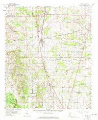
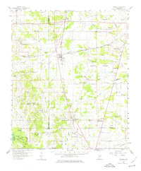
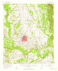
Editions of this 1959 Artesia Map
3 editions found
Other maps of this area

1953 · West Point
USGS Topo · 1:250,000

1958 · West Point
USGS Topo · 1:250,000
1959 · West Point
USGS Topo · 1:62,500

1959 · Pheba
USGS Topo · 1:62,500
1960 · Caledonia
USGS Topo · 1:62,500
1960 · Columbus
USGS Topo · 1:62,500

1963 · West Point
USGS Topo · 1:250,000
1965 · Starkville
USGS Topo · 1:24,000

1965 · Bluff Lake
USGS Topo · 1:24,000
1973 · Cliftonville
USGS Topo · 1:24,000