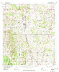
1959 Map of Artesia
USGS Topo · Published 1972About this map
Artesia serves as a central junction on this mid-century survey, where the Gulf Mobile and Ohio railroad corridors converge amidst a landscape of rural schoolhouses and country churches. The transition between the prairie and the bottomlands is marked by numerous watercourses including Catalpa Creek and the Noxubee River, while the southwestern corner highlights the National Wildlife Refuge with its system of floodgates and levees. Local community life is evidenced by a high density of small-scale landmarks such as Truevine Sch, Curtis Chapel, and the Oktibbeha Airport. Farther south, the settlement of Crawford stands as a significant rail-side hub, surrounded by family-named cemeteries and churches like Charity Mission Ch and Fairview Ch, providing a detailed look at the social and transport geography of the area before modern consolidation.
Find a feature on this map
77 named features on this map. Tap any name to fly to it.
Don’t see what you’re looking for? This feature index may not catch every label — zoom into the map to look around manually.
Map Details
Editions of this 1959 Artesia Map
3 editions found
Other maps of this area

1953 · West Point
USGS Topo · 1:250,000

1958 · West Point
USGS Topo · 1:250,000

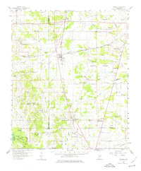
1959 · Artesia
USGS Topo · 1:62,500

1959 · West Point
USGS Topo · 1:62,500

1959 · Pheba
USGS Topo · 1:62,500

1960 · Caledonia
USGS Topo · 1:62,500

1960 · Columbus
USGS Topo · 1:62,500

1963 · West Point
USGS Topo · 1:250,000

1965 · Starkville
USGS Topo · 1:24,000

1965 · Bluff Lake
USGS Topo · 1:24,000