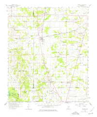
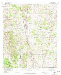
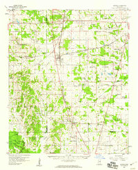
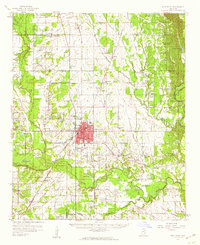
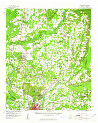
1959 Map of Artesia
USGS Topo · Published 1976About this map
The Gulf Mobile And Ohio railroad serves as the industrial spine of this mid-century landscape, connecting the junction at Artesia with rural outposts like Crawford and Mayhew. This 1959 survey reveals a deeply settled agricultural region defined by a dense network of country schools and churches, reflecting the community structure of Lowndes and Oktibbeha counties before the consolidation of rural districts. Small schoolhouses such as Blackjack Sch and Truevine Sch are scattered throughout the territory, often situated near family cemeteries like Seitz Cem or Parrish Cem. To the southwest, the Noxubee National Wildlife Refuge preserves the bottomlands along the Noxubee River, where the terrain transitions from the upland prairie into the swampy reaches of the Oktoc Br and Shotbag Creek.
Find a feature on this map
79 named features on this map. Tap any name to fly to it.
Don’t see what you’re looking for? This feature index may not catch every label — zoom into the map to look around manually.
Map Details
Editions of this 1959 Artesia Map
3 editions found
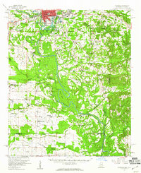
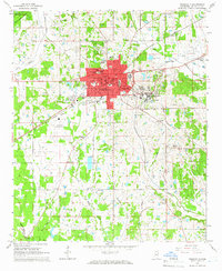
Other maps of this area

1953 · West Point
USGS Topo · 1:250,000

1958 · West Point
USGS Topo · 1:250,000
1959 · Artesia
USGS Topo · 1:62,500
1959 · West Point
USGS Topo · 1:62,500

1959 · Pheba
USGS Topo · 1:62,500
1960 · Caledonia
USGS Topo · 1:62,500
1960 · Columbus
USGS Topo · 1:62,500

1963 · West Point
USGS Topo · 1:250,000
1965 · Starkville
USGS Topo · 1:24,000

1965 · Bluff Lake
USGS Topo · 1:24,000