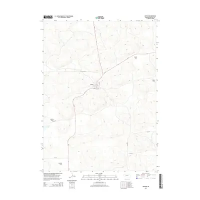
2014 Map of Arthur
USGS Topo · Published 2014About this map
Arthur serves as the primary focal point of this Nebraska Sandhills survey, situated at the junction of Ne-61 and Ne-92. The village layout is clearly defined by several local streets including Heath St, Elm St, and Cullinan St, indicating a structured settlement amidst the undulating topography of Arthur County. The landscape is characterized by its numerous named depressions and elevations, which reveal a history of local land use and naming conventions tied to prominent families and geographic landmarks.
Find a feature on this map
26 named features on this map. Tap any name to fly to it.
Don’t see what you’re looking for? This feature index may not catch every label — zoom into the map to look around manually.
Map Details
Editions of this 2014 Arthur Map
This is the sole edition of this map. No revisions or reprints were ever made.
Other maps of this area

1897 · Ogallala
USGS Topo · 1:125,000

1900 · Ogallala
USGS Topo · 1:125,000

1949 · Arthur
USGS Topo · 1:62,500

1950 · Velma
USGS Topo · 1:62,500

1950 · Arthur
USGS Topo · 1:62,500

1954 · North Platte
USGS Topo · 1:250,000

1956 · North Platte
USGS Topo · 1:250,000

1957 · North Platte
USGS Topo · 1:250,000

1967 · North Platte
USGS Topo · 1:250,000
1971 · Bear Hill
USGS Topo · 1:24,000