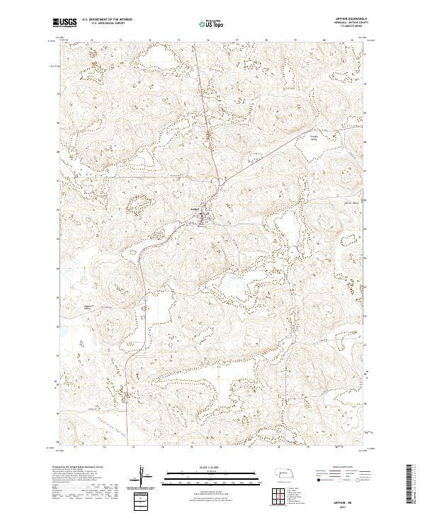
2021 Map of Arthur
USGS Topo · Published 2021About this map
The village of Arthur serves as the central hub of this Sandhills landscape, situated near the Arthur County Courthouse. This high-plains terrain is characterized by a series of distinct valleys and seasonal water bodies that define the local ranching geography. Named depressions such as Triangle Valley, Helmer Valley, Haythorn Valley, and Thoelecke Valley indicate a landscape where low-lying areas are essential for water and settlement. Numerous small lakes and ponds, including Curtiss Lake, Jensen Lake, and the uniquely named Bean Soup Lake, dot the region between sandy ridges like Bear Hill. The road network, including Keystone Rd and Sillassen Rd, connects the village to outlying points like Packard Ranch and Spotted Horse Valley, reflecting a sparse but vital transport system in one of Nebraska's most lightly populated counties.
Find a feature on this map
32 named features on this map. Tap any name to fly to it.
Don’t see what you’re looking for? This feature index may not catch every label — zoom into the map to look around manually.
Map Details
Editions of this 2021 Arthur Map
This is the sole edition of this map. No revisions or reprints were ever made.
Other maps of this area

1897 · Ogallala
USGS Topo · 1:125,000

1900 · Ogallala
USGS Topo · 1:125,000

1949 · Arthur
USGS Topo · 1:62,500

1950 · Velma
USGS Topo · 1:62,500

1950 · Arthur
USGS Topo · 1:62,500

1954 · North Platte
USGS Topo · 1:250,000

1956 · North Platte
USGS Topo · 1:250,000

1957 · North Platte
USGS Topo · 1:250,000

1967 · North Platte
USGS Topo · 1:250,000
1971 · Bear Hill
USGS Topo · 1:24,000