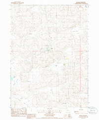
1985 Map of Arthur
USGS Topo · Published 1986About this map
The village of Arthur serves as the central hub for this ranching landscape in the Nebraska Sandhills during the mid-1980s. As the seat of the least populous county in the state, the settlement is anchored by the Arthur Co Fairgrounds and a local Cem, reflecting its role as a vital community center for the surrounding cattle country. The map detail illustrates the characteristic topography of the region, where broad lowlands like Triangle Valley, Haythorn Valley, and Thoelecke Valley cut through the sandy hills.
Find a feature on this map
18 named features on this map. Tap any name to fly to it.
Don’t see what you’re looking for? This feature index may not catch every label — zoom into the map to look around manually.
Map Details
Editions of this 1985 Arthur Map
This is the sole edition of this map. No revisions or reprints were ever made.
Other maps of this area

1897 · Ogallala
USGS Topo · 1:125,000

1900 · Ogallala
USGS Topo · 1:125,000

1949 · Arthur
USGS Topo · 1:62,500

1950 · Velma
USGS Topo · 1:62,500

1950 · Arthur
USGS Topo · 1:62,500

1954 · North Platte
USGS Topo · 1:250,000

1956 · North Platte
USGS Topo · 1:250,000

1957 · North Platte
USGS Topo · 1:250,000

1967 · North Platte
USGS Topo · 1:250,000
1971 · Bear Hill
USGS Topo · 1:24,000