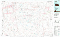
1985 Map of Arthur
USGS Topo · Published 1989About this map
Arthur and Hyannis anchor this mid-1980s look at the Nebraska Sandhills, a landscape defined by an intricate network of valleys and ephemeral lakes. The area's reliance on aviation for ranching and transport is evident through specialized sites like the Hawkins Ranch Airstrip, Snyder Ranch Landing Strip, and Merry Airstrip. The B N railroad line cuts across the northern section near Hyannis, while the rest of the terrain is a labyrinth of named depressions such as Coyote Valley and Colburn Valley. Large water bodies like Bean Soup Lake and Diamond Bar Lake punctuate the grass-stabilized dunes, providing critical landmarks in this ranching country. The Dismal River and its North Fork represent the primary drainage, carving through a region where roads like 91 and 61 trace the natural contours of the sand hills.
Find a feature on this map
119 named features on this map. Tap any name to fly to it.
Don’t see what you’re looking for? This feature index may not catch every label — zoom into the map to look around manually.
Map Details
Editions of this 1985 Arthur Map
2 editions found
Other maps of this area

1897 · Ogallala
USGS Topo · 1:125,000

1898 · Paxton
USGS Topo · 1:125,000

1899 · North Platte
USGS Topo · 1:125,000

1900 · Chappell
USGS Topo · 1:125,000

1900 · Ogallala
USGS Topo · 1:125,000

1901 · Paxton
USGS Topo · 1:125,000

1902 · North Platte
USGS Topo · 1:125,000

1947 · Dismal River Ranch
USGS Topo · 1:62,500

1948 · Seneca
USGS Topo · 1:62,500

1948 · Ashby
USGS Topo · 1:62,500