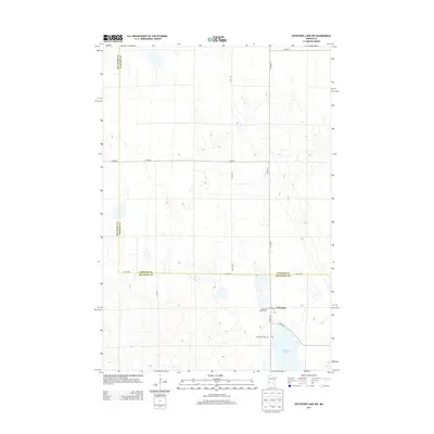
2013 Map of Artichoke Lake NW
USGS Topo · Published 2013About this map
Artichoke Lake dominates the southeast corner of this rural landscape where the border of Big Stone and Stevens counties is defined by Co Line Rd. The small community of Artichoke serves as a local hub, anchored by essential community infrastructure including a Po and the Artichoke Baptist Cem. The geography here is a classic Minnesota prairie mosaic of small wetlands and agricultural fields, crisscrossed by a grid of county roads like Co Hwy-13 and 610th Ave. For those tracing local heritage, the presence of both the Baptist cemetery and the Artichoke Lake Cem provides specific points of interest for family research within this quiet corner of the state.
Find a feature on this map
16 named features on this map. Tap any name to fly to it.
Don’t see what you’re looking for? This feature index may not catch every label — zoom into the map to look around manually.
Map Details
Editions of this 2013 Artichoke Lake NW Map
This is the sole edition of this map. No revisions or reprints were ever made.
Other maps of this area

1910 · Chokio
USGS Topo · 1:62,500

1912 · Chokio
USGS Topo · 1:62,500

1950 · Graceville
USGS Topo · 1:62,500

1953 · Ortonville
USGS Topo · 1:62,500

1953 · Milbank
USGS Topo · 1:250,000

1958 · Milbank
USGS Topo · 1:250,000

1968 · Dry Wood Lake
USGS Topo · 1:24,000

1968 · Lake Oliver
USGS Topo · 1:24,000

1968 · Artichoke Lake NW
USGS Topo · 1:24,000

1968 · Artichoke Lake
USGS Topo · 1:24,000