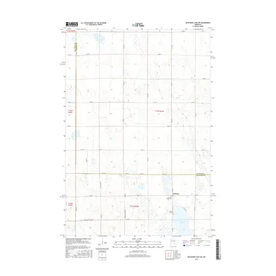
2016 Map of Artichoke Lake NW
USGS Topo · Published 2016About this map
Artichoke Lake dominates the southeastern corner of this landscape, its waters surrounded by the low-lying prairie topography of western Minnesota. The settlement of Artichoke and its surrounding agricultural homesteads are linked by a precise grid of rural roads, including Co Hwy 8 and 600th Ave. Genealogists will find the Artichoke Baptist Cem and Artichoke Lake Cem as key markers of the community's heritage along the eastern shore. The boundary between Big Stone and Stevens Counties runs through the northern and eastern portions of the map, following Co Line Rd. This survey documents a quiet farming district defined by its numerous small wetlands and a road network that adheres strictly to section lines, reflecting the enduring influence of the Public Land Survey System on the regional layout.
Find a feature on this map
39 named features on this map. Tap any name to fly to it.
Don’t see what you’re looking for? This feature index may not catch every label — zoom into the map to look around manually.
Map Details
Editions of this 2016 Artichoke Lake NW Map
This is the sole edition of this map. No revisions or reprints were ever made.
Other maps of this area

1910 · Chokio
USGS Topo · 1:62,500

1912 · Chokio
USGS Topo · 1:62,500

1950 · Graceville
USGS Topo · 1:62,500

1953 · Ortonville
USGS Topo · 1:62,500

1953 · Milbank
USGS Topo · 1:250,000

1958 · Milbank
USGS Topo · 1:250,000

1968 · Dry Wood Lake
USGS Topo · 1:24,000

1968 · Lake Oliver
USGS Topo · 1:24,000

1968 · Artichoke Lake NW
USGS Topo · 1:24,000

1968 · Artichoke Lake
USGS Topo · 1:24,000