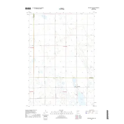
2019 Map of Artichoke Lake NW
USGS Topo · Published 2019About this map
Artichoke Lake dominates the southeastern corner of this landscape, where the prairie gives way to a complex network of wetlands and small basins. The small settlement of Artichoke sits at a crossroads just north of the lake, serving as a focal point for the surrounding agricultural community. Significant for genealogists and local historians are the two burial sites located here: the Artichoke Baptist Cem and the Artichoke Lake Cem, which anchor the long-standing community heritage of this region. To the northwest, the aptly named Dismal Swamp provides a stark contrast to the gridded section lines and gravel roads like Co Line Rd that define the county boundary. The survey reveals a meticulously partitioned territory, where even a Minimum Maintenance Rd highlights the practical requirements of navigating this rural Big Stone County terrain.
Find a feature on this map
29 named features on this map. Tap any name to fly to it.
Don’t see what you’re looking for? This feature index may not catch every label — zoom into the map to look around manually.
Map Details
Editions of this 2019 Artichoke Lake NW Map
This is the sole edition of this map. No revisions or reprints were ever made.
Other maps of this area

1910 · Chokio
USGS Topo · 1:62,500

1912 · Chokio
USGS Topo · 1:62,500

1950 · Graceville
USGS Topo · 1:62,500

1953 · Ortonville
USGS Topo · 1:62,500

1953 · Milbank
USGS Topo · 1:250,000

1958 · Milbank
USGS Topo · 1:250,000

1968 · Dry Wood Lake
USGS Topo · 1:24,000

1968 · Lake Oliver
USGS Topo · 1:24,000

1968 · Artichoke Lake NW
USGS Topo · 1:24,000

1968 · Artichoke Lake
USGS Topo · 1:24,000