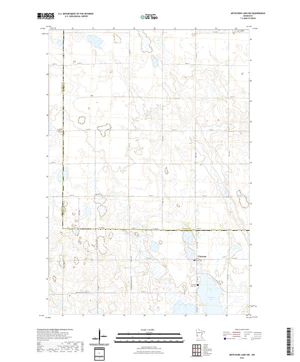
2022 Map of Artichoke Lake NW
USGS Topo · Published 2022About this map
Artichoke Lake dominates the southeast corner of this West Central Minnesota landscape, where the prairie meets the wetland systems of the Big Stone and Stevens county line. The small community of Artichoke serves as a local focal point, surrounded by agricultural tracts organized by a strict grid of section lines and gravel roads. For those researching local history or genealogy, the area preserves important community landmarks such as the Artichoke Baptist Cem and the Artichoke Lake Cem, both situated near the northern tip of the lake. The terrain is characterized by numerous small depressions and sloughs, typical of glacial till plains, with transport defined by routes like Co Hwy 8 and Co Line Rd which bridge the two counties. This survey illustrates the persistent rural character of the region and the significant role water bodies play in defining the local geography.
Find a feature on this map
40 named features on this map. Tap any name to fly to it.
Don’t see what you’re looking for? This feature index may not catch every label — zoom into the map to look around manually.
Map Details
Editions of this 2022 Artichoke Lake NW Map
This is the sole edition of this map. No revisions or reprints were ever made.
Other maps of this area

1910 · Chokio
USGS Topo · 1:62,500

1912 · Chokio
USGS Topo · 1:62,500

1950 · Graceville
USGS Topo · 1:62,500

1953 · Ortonville
USGS Topo · 1:62,500

1953 · Milbank
USGS Topo · 1:250,000

1958 · Milbank
USGS Topo · 1:250,000

1968 · Dry Wood Lake
USGS Topo · 1:24,000

1968 · Lake Oliver
USGS Topo · 1:24,000

1968 · Artichoke Lake NW
USGS Topo · 1:24,000

1968 · Artichoke Lake
USGS Topo · 1:24,000