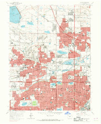
1965 Map of Arvada
USGS Topo · Published 1969About this map
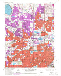
Clear Creek and Ralston Creek define the hydrology of this mid-1960s landscape, which marks a transition from open terrain to suburban expansion north of Denver. The area is densely populated with community institutions, including the State Home and Training School (Ridge Home) and numerous specialized parochial facilities such as St Claras Orphanage and the Little Sisters of the Poor. Transportation networks are dominated by the Boulder Denver Turnpike (Toll Road) and the Colorado and Southern railroad lines.
Find a feature on this map
132 named features on this map. Tap any name to fly to it.
Don’t see what you’re looking for? This feature index may not catch every label — zoom into the map to look around manually.
Map Details
Editions of this 1965 Arvada Map
6 editions found
Other maps of this area

1890 · East Denver
USGS Topo · 1:125,000

1899 · West Denver
USGS Topo · 1:125,000

1935 · East Denver Nos. 3 and 4
USGS Topo · 1:48,000

1938 · Morrison
USGS Topo · 1:24,000

1938 · Derby
USGS Topo · 1:24,000

1939 · Golden
USGS Topo · 1:24,000

1940 · Englewood
USGS Topo · 1:31,680

1940 · Eastlake
USGS Topo · 1:31,680

1940 · Lafayette
USGS Topo · 1:31,680

1940 · Derby
USGS Topo · 1:31,680