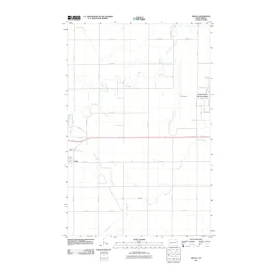
2011 Map of Arvilla
USGS Topo · Published 2011About this map
The small settlement of Arvilla sits at the intersection of a vast agricultural grid and the meandering path of the Turtle River. This 2011 survey captures the town's quiet residential footprint just south of the Arvilla Cemetery, a key site for local genealogical research. To the east, the landscape is defined by the massive infrastructure of the Grand Forks Air Force Base, where a complex street network including Eielson St, Holzapple St, and Steen Ave serves the military installation. The contrast between the river's natural winding course and the rigid geometric layout of the base and a nearby Landing Strip illustrates the dual identity of this prairie landscape. Waterways like Hazen Brook drain the surrounding fields, highlighting the area's essential drainage patterns in a region where the flat terrain was meticulously organized for both defense and farming.
Find a feature on this map
38 named features on this map. Tap any name to fly to it.
Don’t see what you’re looking for? This feature index may not catch every label — zoom into the map to look around manually.
Map Details
Editions of this 2011 Arvilla Map
This is the sole edition of this map. No revisions or reprints were ever made.
Other maps of this area

1926 · Ardoch
USGS Topo · 1:62,500

1934 · Emerado
USGS Topo · 1:48,000

1936 · Emerado
USGS Topo · 1:62,500

1936 · Larimore
USGS Topo · 1:62,500

1952 · Grand Forks
USGS Topo · 1:250,000

1952 · Thief River Falls
USGS Topo · 1:250,000

1956 · Thief River Falls
USGS Topo · 1:250,000

1956 · Grand Forks
USGS Topo · 1:250,000

1957 · Thief River Falls
USGS Topo · 1:250,000

1963 · Larimore East
USGS Topo · 1:24,000