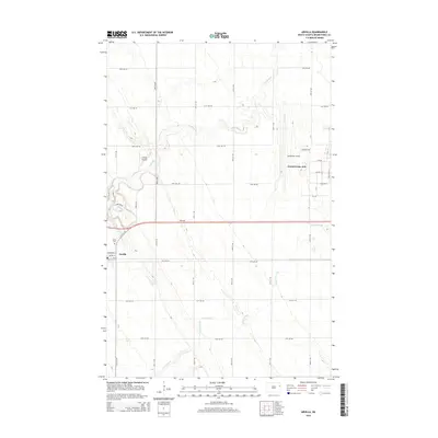
2014 Map of Arvilla
USGS Topo · Published 2014About this map
Arvilla serves as the primary residential anchor in this corner of Grand Forks County, situated along a landscape defined by the winding course of the Turtle River. The map illustrates a high degree of local aviation and military infrastructure, most notably the western portion of Grand Forks AFB and two private landing strips, Frokjer Airport and Casslindan Airport. These features, along with the proximity of Hazen Brook, reflect a region where military operations and agricultural aviation intersect with traditional township settlements. For genealogists, the Arvilla Cem and the residential grid including Hartford St and Halsey St provide specific geographic points of interest for tracing local family history and property locations in the early 21st century.
Find a feature on this map
22 named features on this map. Tap any name to fly to it.
Don’t see what you’re looking for? This feature index may not catch every label — zoom into the map to look around manually.
Map Details
Editions of this 2014 Arvilla Map
This is the sole edition of this map. No revisions or reprints were ever made.
Other maps of this area

1926 · Ardoch
USGS Topo · 1:62,500

1934 · Emerado
USGS Topo · 1:48,000

1936 · Emerado
USGS Topo · 1:62,500

1936 · Larimore
USGS Topo · 1:62,500

1952 · Grand Forks
USGS Topo · 1:250,000

1952 · Thief River Falls
USGS Topo · 1:250,000

1956 · Thief River Falls
USGS Topo · 1:250,000

1956 · Grand Forks
USGS Topo · 1:250,000

1957 · Thief River Falls
USGS Topo · 1:250,000

1963 · Larimore East
USGS Topo · 1:24,000