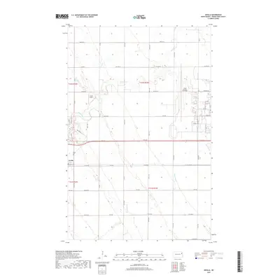
2018 Map of Arvilla
USGS Topo · Published 2018About this map
Arvilla sits at the intersection of a vast grid of section roads and the winding course of the Turtle River, which snakes across the northern portion of the landscape. This area of Grand Forks County shows the intersection of civilian life and military infrastructure, characterized by the expansive footprint of the Grand Forks Air Force Base on the eastern edge. Local aviation is further represented by the Frokjer Airport tucked into a bend of the river. The terrain is defined by low-relief drainage patterns, notably Hazen Brook, which flows through the southern reaches. Recreational and local paths like the Moose Head Trail provide a break from the rigid township and range lines, offering a glimpse into how the local community interacts with the river's edge and the surrounding North Dakota prairie.
Find a feature on this map
40 named features on this map. Tap any name to fly to it.
Don’t see what you’re looking for? This feature index may not catch every label — zoom into the map to look around manually.
Map Details
Editions of this 2018 Arvilla Map
This is the sole edition of this map. No revisions or reprints were ever made.
Other maps of this area

1926 · Ardoch
USGS Topo · 1:62,500

1934 · Emerado
USGS Topo · 1:48,000

1936 · Emerado
USGS Topo · 1:62,500

1936 · Larimore
USGS Topo · 1:62,500

1952 · Grand Forks
USGS Topo · 1:250,000

1952 · Thief River Falls
USGS Topo · 1:250,000

1956 · Thief River Falls
USGS Topo · 1:250,000

1956 · Grand Forks
USGS Topo · 1:250,000

1957 · Thief River Falls
USGS Topo · 1:250,000

1963 · Larimore East
USGS Topo · 1:24,000