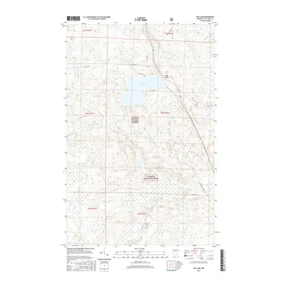
2016 Map of Ash Lake
USGS Topo · Published 2016About this map
Ash Lake dominates the upper-central portion of this map, serving as a focal point for a landscape defined by timber management and water drainage. Set within the bounds of the Superior National Forest, the region is marked by a network of specialized access routes like the Lost River Management Rd and Old Ash Lake Rd. These roads suggest a continued reliance on forest maintenance and resource management in Saint Louis County.
Find a feature on this map
18 named features on this map. Tap any name to fly to it.
Don’t see what you’re looking for? This feature index may not catch every label — zoom into the map to look around manually.
Map Details
Editions of this 2016 Ash Lake Map
This is the sole edition of this map. No revisions or reprints were ever made.
Other maps of this area

1954 · International Falls
USGS Topo · 1:250,000

1957 · International Falls
USGS Topo · 1:250,000

1958 · International Falls
USGS Topo · 1:250,000

1968 · Ash River SE
USGS Topo · 1:24,000

1968 · Ash Lake
USGS Topo · 1:24,000

1968 · Ash River SW
USGS Topo · 1:24,000
1968 · Orr NE
USGS Topo · 1:24,000

1968 · Orr SW
USGS Topo · 1:24,000
1968 · Orr
USGS Topo · 1:24,000

1969 · Ray SE
USGS Topo · 1:24,000