
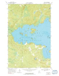
1968 Map of Orr SW
USGS Topo · Published 1971About this map
Kabetogama State Forest dominates this northern Minnesota landscape, where the expansive waters of Kabetogama Lake are punctuated by numerous landforms including Big Island, Baileys Island, and Backus Island. The shoreline is deeply indented with sheltered waters like Susan Bay, Saunders Bay, and Elliott Point, indicating a geography defined by post-glacial drainage patterns.
Find a feature on this map
17 named features on this map. Tap any name to fly to it.
Don’t see what you’re looking for? This feature index may not catch every label — zoom into the map to look around manually.
Map Details
Editions of this 1968 Orr SW Map
2 editions found
Other maps of this area

1954 · Hibbing
USGS Topo · 1:250,000

1954 · International Falls
USGS Topo · 1:250,000

1957 · Hibbing
USGS Topo · 1:250,000

1957 · International Falls
USGS Topo · 1:250,000

1958 · International Falls
USGS Topo · 1:250,000

1958 · Hibbing
USGS Topo · 1:250,000

1964 · Hibbing
USGS Topo · 1:250,000

1964 · Gheen NW
USGS Topo · 1:24,000

1964 · Gheen
USGS Topo · 1:24,000

1968 · Ash Lake
USGS Topo · 1:24,000