
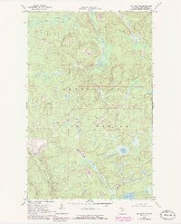
1968 Map of Ash River SE
USGS Topo · Published 1971About this map
Kabetogama State Forest dominates this northern Minnesota landscape, characterized by a complex network of waterways and seasonal access routes. The Ash River winds through the northern sections, joined by tributaries such as Camp 90 Creek and Gannon Creek. To the south, the Black Duck River and Ninemile Creek drain through marshy lowlands, punctuated by isolated bodies of water like Corner Lake and Chub Lake. The prevalence of Winter Roads and several Winter Trails underscores the seasonal nature of transit and resource extraction in this environment, where frozen ground historically provided the necessary stability for moving heavy equipment or timber. A solitary Gravel Pit near Long Lake suggests localized industrial activity amidst the dense forest and wetland cover of St. Louis County.
Find a feature on this map
15 named features on this map. Tap any name to fly to it.
Don’t see what you’re looking for? This feature index may not catch every label — zoom into the map to look around manually.
Map Details
Editions of this 1968 Ash River SE Map
2 editions found
Other maps of this area

1954 · International Falls
USGS Topo · 1:250,000

1957 · International Falls
USGS Topo · 1:250,000

1958 · International Falls
USGS Topo · 1:250,000

1967 · Namakan Island
USGS Topo · 1:24,000

1967 · Marion Lake
USGS Topo · 1:24,000

1967 · Elephant Lake
USGS Topo · 1:24,000

1968 · Daley Bay
USGS Topo · 1:24,000

1968 · Ash Lake
USGS Topo · 1:24,000

1968 · Ash River NE
USGS Topo · 1:24,000

1968 · Ash River SW
USGS Topo · 1:24,000