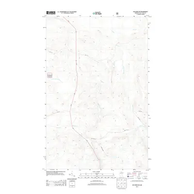
2013 Map of Ash River SW
USGS Topo · Published 2013About this map
Superior National Forest encompasses this section of Northern Minnesota, where the drainage networks of several major waterways converge. The Ash River meanders across the central and northern terrain, joined by the Black Duck River as it flows from the east. The landscape is characterized by its dense water systems, including the East Br Rat Root River in the west and smaller tributaries like Kinmount Cr and Faun Cr.
Find a feature on this map
13 named features on this map. Tap any name to fly to it.
Don’t see what you’re looking for? This feature index may not catch every label — zoom into the map to look around manually.
Map Details
Editions of this 2013 Ash River SW Map
This is the sole edition of this map. No revisions or reprints were ever made.
Other maps of this area

1954 · International Falls
USGS Topo · 1:250,000

1957 · International Falls
USGS Topo · 1:250,000

1958 · International Falls
USGS Topo · 1:250,000

1968 · Daley Bay
USGS Topo · 1:24,000

1968 · Ash River SE
USGS Topo · 1:24,000

1968 · Ash Lake
USGS Topo · 1:24,000

1968 · Ash River NE
USGS Topo · 1:24,000

1968 · Ash River SW
USGS Topo · 1:24,000
1968 · Orr NE
USGS Topo · 1:24,000

1969 · Ray SE
USGS Topo · 1:24,000