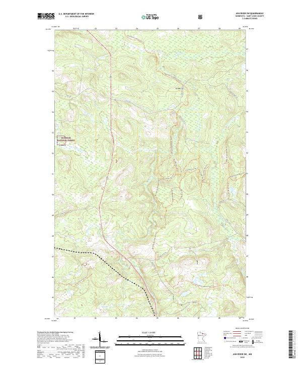
2022 Map of Ash River SW
USGS Topo · Published 2022About this map
Superior National Forest encompasses this stretch of St. Louis County, where the hydrological network of the Ash River and Black Duck River dictates the landscape. The region is defined by its extensive system of timber and recreational paths, most notably the David Dill-Arrowhead State Trl which traverses the terrain alongside numerous industrial spurs. These corridors, such as the Boise Cascade Spur A Trl and various Gary Road Spur A Trl segments, reflect the importance of the forest products industry to this part of Northern Minnesota.
Find a feature on this map
30 named features on this map. Tap any name to fly to it.
Don’t see what you’re looking for? This feature index may not catch every label — zoom into the map to look around manually.
Map Details
Editions of this 2022 Ash River SW Map
This is the sole edition of this map. No revisions or reprints were ever made.
Other maps of this area

1954 · International Falls
USGS Topo · 1:250,000

1957 · International Falls
USGS Topo · 1:250,000

1958 · International Falls
USGS Topo · 1:250,000

1968 · Daley Bay
USGS Topo · 1:24,000

1968 · Ash River SE
USGS Topo · 1:24,000

1968 · Ash Lake
USGS Topo · 1:24,000

1968 · Ash River NE
USGS Topo · 1:24,000

1968 · Ash River SW
USGS Topo · 1:24,000
1968 · Orr NE
USGS Topo · 1:24,000

1969 · Ray SE
USGS Topo · 1:24,000