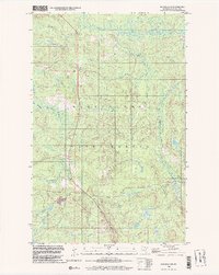
1999 Map of Ash River SW
USGS Topo · Published 2003About this map
Kabetogama State Forest dominates this northern Minnesota landscape, where the meandering course of the Ash River defines the drainage patterns of St. Louis County. The settlement of Kinmount serves as a primary local landmark, positioned near the headwaters of Kinmount Creek and along a north-south corridor that includes a local Gravel Pit and the small Our Lady of Fatima Ch.
Find a feature on this map
13 named features on this map. Tap any name to fly to it.
Don’t see what you’re looking for? This feature index may not catch every label — zoom into the map to look around manually.
Map Details
Editions of this 1999 Ash River SW Map
This is the sole edition of this map. No revisions or reprints were ever made.
Other maps of this area

1954 · International Falls
USGS Topo · 1:250,000

1957 · International Falls
USGS Topo · 1:250,000

1958 · International Falls
USGS Topo · 1:250,000

1968 · Daley Bay
USGS Topo · 1:24,000

1968 · Ash River SE
USGS Topo · 1:24,000

1968 · Ash Lake
USGS Topo · 1:24,000

1968 · Ash River NE
USGS Topo · 1:24,000

1968 · Ash River SW
USGS Topo · 1:24,000
1968 · Orr NE
USGS Topo · 1:24,000

1969 · Ray SE
USGS Topo · 1:24,000