
1969 Map of Ash Springs
USGS Topo · Published 1973About this map
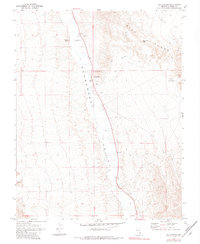
Pahranagat Valley serves as the central corridor of this Nevada landscape, where the settlement of Ash Springs acts as a primary focal point at the base of the towering Hiko Range. This 1969 field check reveals a remote desert environment defined by water sources and industrial markings, including Brownie Spring to the west and several resource extraction sites like a Borrow Pit and Gravel Pit. The map captures the infrastructure of the late 1960s, showing a rugged network of travel routes such as the Jeep Trail winding through the terrain. To the east, the topography becomes significantly more complex near Table Top Mtn and the evocatively named Hells Half Acre. A site marked simply as Ruins further south in the valley offers a specific point of interest for those studying the physical remnants of earlier habitation in Lincoln County.
Find a feature on this map
14 named features on this map. Tap any name to fly to it.
Don’t see what you’re looking for? This feature index may not catch every label — zoom into the map to look around manually.
Map Details
Editions of this 1969 Ash Springs Map
2 editions found
Other maps of this area

1945 · Alamo
USGS Topo · 1:125,000

1954 · Caliente
USGS Topo · 1:250,000

1959 · Caliente
USGS Topo · 1:250,000

1969 · Alamo SE
USGS Topo · 1:24,000

1969 · Alamo NE
USGS Topo · 1:24,000

1969 · Alamo
USGS Topo · 1:24,000

1970 · Hiko SE
USGS Topo · 1:24,000

1970 · Hiko
USGS Topo · 1:24,000
1980 · Alamo
USGS Topo · 1:24,000
1980 · Alamo SE
USGS Topo · 1:24,000