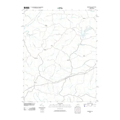
2010 Map of Ashbrook
USGS Topo · Published 2010About this map
Ashbrook serves as a central point in this rural landscape, situated where Beaver Creek and Puncheon Creek converge. The terrain is defined by several prominent ridges and a complex network of waterways, including the Salt River in the northwest and the Chaplin River at the southern boundary. Small, dispersed settlements such as Sinai, Klondyke, and Johnsonville suggest a long-standing pattern of agricultural hamlets. Genealogists may find interest in the centrally located Leathers Cemetery, while the presence of Drydock near the northern edge hints at localized naming traditions or bygone activities. The Blue Grass Pkwy cuts across the southern portion, reflecting modern infrastructure laid over an older landscape of creeks and family-named roads like Buntain School Rd and Rutherford School Rd.
Find a feature on this map
72 named features on this map. Tap any name to fly to it.
Don’t see what you’re looking for? This feature index may not catch every label — zoom into the map to look around manually.
Map Details
Editions of this 2010 Ashbrook Map
This is the sole edition of this map. No revisions or reprints were ever made.
Other maps of this area

1905 · Harrodsburg
USGS Topo · 1:125,000

1922 · Frankfort
USGS Topo · 1:48,000

1923 · Waddy
USGS Topo · 1:48,000

1924 · Frankfort
USGS Topo · 1:62,500

1925 · Mount Eden
USGS Topo · 1:48,000

1927 · Mount Eden
USGS Topo · 1:62,500

1951 · Lawrenceburg
USGS Topo · 1:24,000

1952 · Cornishville
USGS Topo · 1:24,000

1952 · Ashbrook
USGS Topo · 1:24,000

1952 · Chaplin
USGS Topo · 1:24,000