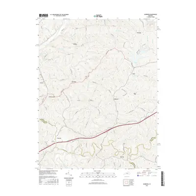
2016 Map of Ashbrook
USGS Topo · Published 2016About this map
Ashbrook sits at the intersection of rural agriculture and modern transportation, where the rolling hills of central Kentucky are partitioned by the multi-lane Bluegrass Pkwy. This landscape is defined by its numerous small-scale settlements and homestead clusters, such as Sinai, Klondyke, and Johnsonville, which are connected by a network of local roads including Bardstown Rd and Leathers Rd. The terrain is deeply carved by water, with the Salt River and Chaplin River framing the north and south, while interior drainages like Beaver Cr and Puncheon Cr create the varied elevation that characterizes the area.
Find a feature on this map
92 named features on this map. Tap any name to fly to it.
Don’t see what you’re looking for? This feature index may not catch every label — zoom into the map to look around manually.
Map Details
Editions of this 2016 Ashbrook Map
This is the sole edition of this map. No revisions or reprints were ever made.
Other maps of this area

1905 · Harrodsburg
USGS Topo · 1:125,000

1922 · Frankfort
USGS Topo · 1:48,000

1923 · Waddy
USGS Topo · 1:48,000

1924 · Frankfort
USGS Topo · 1:62,500

1925 · Mount Eden
USGS Topo · 1:48,000

1927 · Mount Eden
USGS Topo · 1:62,500

1951 · Lawrenceburg
USGS Topo · 1:24,000

1952 · Cornishville
USGS Topo · 1:24,000

1952 · Ashbrook
USGS Topo · 1:24,000

1952 · Chaplin
USGS Topo · 1:24,000