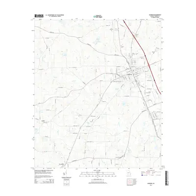
2014 Map of Ashburn
USGS Topo · Published 2014About this map
The city of Ashburn serves as the central hub of this Turner County landscape, where the local road network and rail lines converge amidst a terrain defined by the upper reaches of the Little River. This 2014 survey captures a rural geography punctuated by several family and community burial grounds, including Rose Hill Cem and Green Branch Cem, providing valuable reference points for genealogists. To the south and west, the smaller settlements of Hobby and Coverdale are connected by roads like the Warwick Hwy and Coverdale Hwy. The landscape is scattered with significant water bodies such as Ward Lake W, Story Lake, and Betts Pond, illustrating the hydrology that has shaped agricultural development in the region. The Turner County Airport sits just east of the main town center, marking a modern transition in this traditionally rural Georgia county.
Find a feature on this map
121 named features on this map. Tap any name to fly to it.
Don’t see what you’re looking for? This feature index may not catch every label — zoom into the map to look around manually.
Map Details
Editions of this 2014 Ashburn Map
This is the sole edition of this map. No revisions or reprints were ever made.
Other maps of this area

1953 · Waycross
USGS Topo · 1:250,000

1956 · Sylvester
USGS Topo · 1:62,500

1958 · Waycross
USGS Topo · 1:250,000

1972 · Cuffietown
USGS Topo · 1:24,000

1973 · Sumner
USGS Topo · 1:24,000

1973 · Sylvester
USGS Topo · 1:24,000

1973 · Ashburn
USGS Topo · 1:24,000

1973 · Chula
USGS Topo · 1:24,000

1973 · Bethel
USGS Topo · 1:24,000

1974 · Amboy
USGS Topo · 1:24,000