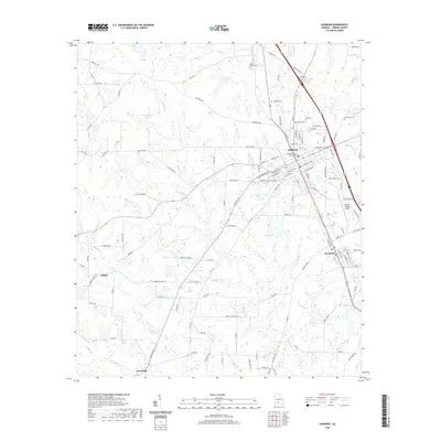
2020 Map of Ashburn
USGS Topo · Published 2020About this map
Ashburn serves as the central hub of this Turner County landscape, where the Turner County Courthouse stands at the heart of a grid-patterned town. The geography is defined by a series of small, scattered water bodies including Story Lake, H E Jones Lake, and Nelson Lake, which alternate with agricultural lands and wooded tracts. To the southeast, the town of Sycamore follows the line of the N-S Railroad Ave, illustrating the historical importance of the rail corridor to the region's development. Smaller settlements such as Coverdale and Hobby anchor the southwestern portion of the map, connected by a network of rural roads like Hobby School Rd. Several family and community burial grounds, including Rose Hill Cem, Sumners Cem, and Widdons Cem, are documented throughout the countryside, offering significant points of interest for those researching the area's ancestral roots.
Find a feature on this map
125 named features on this map. Tap any name to fly to it.
Don’t see what you’re looking for? This feature index may not catch every label — zoom into the map to look around manually.
Map Details
Editions of this 2020 Ashburn Map
This is the sole edition of this map. No revisions or reprints were ever made.
Other maps of this area

1953 · Waycross
USGS Topo · 1:250,000

1956 · Sylvester
USGS Topo · 1:62,500

1958 · Waycross
USGS Topo · 1:250,000

1972 · Cuffietown
USGS Topo · 1:24,000

1973 · Sumner
USGS Topo · 1:24,000

1973 · Sylvester
USGS Topo · 1:24,000

1973 · Ashburn
USGS Topo · 1:24,000

1973 · Chula
USGS Topo · 1:24,000

1973 · Bethel
USGS Topo · 1:24,000

1974 · Amboy
USGS Topo · 1:24,000