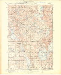
1913 Map of Ashby
USGS Topo · Published 1913About this map
Ashby and Dalton serve as the primary rail-connected hubs in this 1913 survey of the Minnesota lake country. The landscape is defined by its dense concentration of glacial basins, ranging from the expansive Pelican Lake and Tenmile Lake to smaller named bodies like Stalker Lake and Jolly Ann Lake. The Northern Pacific RR and the Great Northern Ry cut through these water bodies, influencing the placement of early rural infrastructure.
Find a feature on this map
71 named features on this map. Tap any name to fly to it.
Don’t see what you’re looking for? This feature index may not catch every label — zoom into the map to look around manually.
Map Details
Editions of this 1913 Ashby Map
4 editions found
Other maps of this area

1910 · Wendell
USGS Topo · 1:62,500

1911 · Barrett
USGS Topo · 1:62,500

1911 · Herman
USGS Topo · 1:62,500

1912 · Battle Lake
USGS Topo · 1:62,500

1913 · Ashby
USGS Topo · 1:62,500

1913 · Fergus Falls
USGS Topo · 1:62,500

1913 · Wendell
USGS Topo · 1:62,500

1914 · Battle Lake
USGS Topo · 1:62,500

1915 · Underwood
USGS Topo · 1:62,500

1953 · Milbank
USGS Topo · 1:250,000