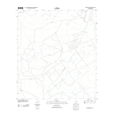
2013 Map of Asherton NW
USGS Topo · Published 2013About this map
The south Texas ranching landscape of Dimmit County is characterized here by a network of seasonal watercourses and large family-held properties. Carrizo Cr and El Barrosa Cr wind through the arid terrain, which is partitioned into expansive tracts such as Brauer Ranch and San Pedro Ranch. The map reveals the persistence of legacy landholding patterns, marking individual homesteads and rural residences including those of Mrs C Bradshaw, LH Huck, and JC Johnson. Transportation through this territory is defined by local routes like Ranch Road 2644 and Farm-To-Market Road 186, which provide the primary connectivity between these isolated ranching headquarters. The layout of Barrier Farms Rd suggests localized agricultural development amidst the broader grazing lands typical of the region near the turn of the 21st century.
Find a feature on this map
24 named features on this map. Tap any name to fly to it.
Don’t see what you’re looking for? This feature index may not catch every label — zoom into the map to look around manually.
Map Details
Editions of this 2013 Asherton NW Map
This is the sole edition of this map. No revisions or reprints were ever made.
Other maps of this area

1929 · Cotulla
USGS Topo · 1:125,000

1939 · Carrizo Springs
USGS Topo · 1:62,500

1940 · Asherton
USGS Topo · 1:62,500

1940 · Cometa
USGS Topo · 1:62,500

1941 · Botella Creek
USGS Topo · 1:62,500

1953 · Crystal City
USGS Topo · 1:250,000

1955 · Crystal City
USGS Topo · 1:250,000

1957 · Botella Creek
USGS Topo · 1:62,500

1958 · Eagle Pass
USGS Topo · 1:250,000

1961 · Crystal City
USGS Topo · 1:250,000