
1953 Map of Ashland
USGS Topo · Published 1964About this map
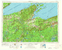
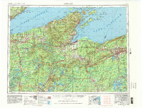
Chequamegon Bay and the south shore of Lake Superior anchor this mid-century survey of Northern Wisconsin and the Michigan borderlands. The maritime landscape is dominated by the Apostle Islands, including Stockton Island and Madeline Island, while the mainland features the extensive Bad River Indian Reservation and Red Cliff Indian Reservation. A complex rail network consisting of the Chicago and North Western and the Soo Line connects timber and mining towns like Ashland, Hurley, and Mellen. Inland, the geography is defined by vast tracts of the Chequamegon National Forest and significant water management features such as the Turtle-Flambeau Flowage and Totagatic Flowage. The map provides a detailed view of the region's mid-century transition from a heavy industrial and timber base toward its role as a recreation and conservation hub.
Find a feature on this map
184 named features on this map. Tap any name to fly to it.
Don’t see what you’re looking for? This feature index may not catch every label — zoom into the map to look around manually.
Map Details
Editions of this 1953 Ashland Map
3 editions found
Other maps of this area

1895 · Duluth
USGS Topo · 1:62,500

1915 · Superior
USGS Topo · 1:48,000

1917 · Superior
USGS Topo · 1:62,500

1938 · Lac Du Flambeau
USGS Topo · 1:48,000

1939 · Lac Du Flambeau
USGS Topo · 1:48,000

1939 · Winchester
USGS Topo · 1:48,000

1940 · Mercer
USGS Topo · 1:48,000

1940 · Butternut
USGS Topo · 1:48,000

1940 · Upson
USGS Topo · 1:48,000

1941 · Bayfield
USGS Topo · 1:48,000