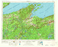
1953 Map of Ashland
USGS Topo · Published 1975About this map
Chequamegon Bay and the industrial waterfront of Ashland anchor this mid-century look at the South Shore of Lake Superior. The landscape is defined by vast public and tribal lands, including the Bad River Indian Reservation and the sprawling reaches of the Chequamegon National Forest. To the north, the Apostle Islands archipelago, featuring Stockton Island and Madeline Island, stretches into the open water. The regional economy of the 1950s is etched into the map through the rail corridors of the Chicago and North Western and the Soo Line, which connected the iron ranges of Ironwood and Hurley to the port. From the small fishing villages of Cornucopia and Herbster to the expansive Turtle-Flambeau Flowage, this survey documents a northern wilderness transitioning from its mining and timber peaks toward a permanent recreation and conservation landscape.
Find a feature on this map
144 named features on this map. Tap any name to fly to it.
Don’t see what you’re looking for? This feature index may not catch every label — zoom into the map to look around manually.
Map Details
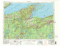
Editions of this 1953 Ashland Map
3 editions found

Other maps of this area

1895 · Duluth
USGS Topo · 1:62,500

1915 · Superior
USGS Topo · 1:48,000

1917 · Superior
USGS Topo · 1:62,500

1938 · Lac Du Flambeau
USGS Topo · 1:48,000

1939 · Lac Du Flambeau
USGS Topo · 1:48,000

1939 · Winchester
USGS Topo · 1:48,000

1940 · Mercer
USGS Topo · 1:48,000

1940 · Butternut
USGS Topo · 1:48,000

1940 · Upson
USGS Topo · 1:48,000

1941 · Bayfield
USGS Topo · 1:48,000